Short update today. Gusty showers and storms this afternoon with association of a strong cold front passage. These winds can pick up suddenly so good idea to keep a close eye on the radar. A brief, isolated spin up can't be ruled out. It's the same system that dropped 3 feet of snow in the Rockies and produced tornadoes in Iowa and Nebraska so it certainly has a history of severe weather. The rain should clear after midnight and tomorrow will be dry and sunny with temps in the 60s.
- Quiet in the Atlantic
- Typhoon Fitow has made landfall in eastern China. Flooding is imminent and cautionary measures are being taken with many evacuations.
- Danas nears Super Typhoon status with max winds at 145mph after rapid strengthening yesterday. As was mentioned yesterday, it already had great structure and well-developed eye. It is now a Category 4 and swinging east toward Japan. Going to be long days ahead for them.
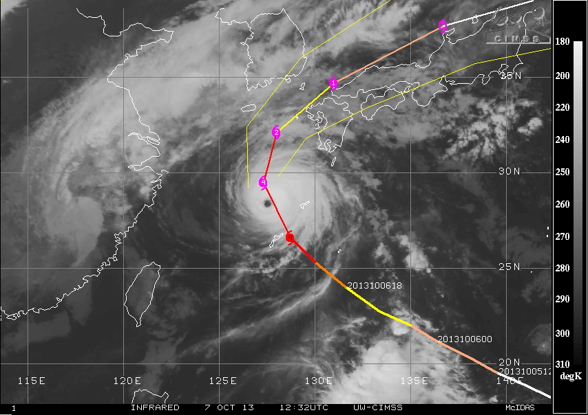 |
| Danas is impressive on infrared after strengthening rapidly yesterday (Credit: CIMSS) |
- Tropical Storm Narda forms in the Eastern Pacific. No land impacts expected.
- There were no earthquakes rated at or above M6 yesterday or so far today.
- Sunspot 1856 produced a C-class flare last night. Shall monitor the possibility for stronger flares around that region. M-class flare percentage have bumped up to 10% in the next 24 hours.
 |
| Sunspot 1856 is active (Credit: SpaceWeather.com) |
No comments:
Post a Comment