Monday, September 30, 2013

9/30/2013 Daily Update: A Repeat Monday, Wutip Makes Landfall in Vietnam, Filament Eruption from Sun

Good morning everyone!

A foggy start to the morning but the fog will break apart leading to another gorgeous afternoon.

TODAY: Sunny with highs in the upper 60s to lower 70s. Calm winds expected.

TONIGHT: Mostly clear skies with lows in the mid 40s. Calm winds.

TOMORROW: Sunny and milder with highs in the mid to upper 70s. Winds from the NW at 5 to 10 mph.

We will make a run above 80 degrees on Wednesday. Another dry week ahead.

NOTE: Tomorrow, details of the 1st annual SNE snowfall contest are going to be released with a list of 100+ cities and towns taking part. Interesting to see who comes out on top this winter!


ATLANTIC TROPICS

  • Tropical Depression Eleven in the Central Atlantic has a shot at being named as it drifts in no man's land.
  • Invest 97L is producing heavy rain and storms in the southern Caribbean. Will watch it slowly move up north and see if it can consolidate in which direction it's heading.

NATIONAL WEATHER

  • Dry and sunny weather for the Northeast. Coastal low pressure system stays away.
  • Scattered showers and storms for the Tennessee valley and the Gulf
  • Generally dry and warm in the South and Midwest
  • Gusty showers for the Northwest and Intermountain region

WORLD WEATHER

  • Typhoon Wutip is making landfall in Vietnam as a strong Category 2 typhoon with maximum sustained winds of 105 mph. Many people have evacuated along the coast and flood-prone areas. This has been the 10th tropical storm or typhoon to impact Vietnam in what has been a busy season for them. http://blogs.wsj.com/searealtime/2013/09/30/typhoon-wutip-heads-for-vietnams-central-coast/
  • Tropical Depression Sepat has formed southeast of Japan and could take a swipe at them middle of the week.as a tropical storm.
  • Tropical Depression Twenty-two has formed east of the Philippines and is moving due north, expected to strengthen further. No land in sight in the near future.
  • Thunderstorms for southern parts of Europe today
  • Showers and storms along a cold front have moved toward southeast Australia
Wutip is the 10th storm or typhoon to strike Vietnam this season.
(Credit: Wunderground)

EARTHQUAKES


SPACE WEATHER

  • A massive filament erupted from the sun yesterday and hurled a CME into space. This looks to be partially Earth-directed so auroras are possible upon its arrival and could spark a geomagnetic storm. More updates to come.
  • Meanwhile, sunspots remain quiet with a 1% chance of M-class flares in the next 24 hours.
Shot of the filament eruption seen here blasting away
on the right side of the sun (Credit: SpaceWeather.com)

Sunday, September 29, 2013

9/29/2013 Daily Update: Sunny and Dry Trend Continues, Milder by Midweek, TD 11 Forms in the Atlantic

Good morning everyone!

Basically, the tape rolls on... sunny and dry for your Sunday.

TODAY: Sunny with highs in the upper 60s to mid 70s. Winds from the SE at 5 mph.

TONIGHT: Partly to mostly cloudy skies with lows in the lower 40s. Winds turning calm.

TOMORROW: Mostly sunny with highs in the lower to mid 70s. Winds from the N at 5 mph.

Looking ahead at next week... a gradual warm-up is expected with temps pushing toward 80 degrees by Wednesday. No rain in sight for the foreseeable future, not until the weekend do we start talking about chances of rain. Signs are next weekend could be wet with moisture arriving from the Gulf. Details yet to be sorted out though.

ATLANTIC TROPICS

  • Invest 96L is now designated Tropical Depression Eleven by the NHC in the Central Atlantic. No impact to land expected and should be relatively short-lived if it does become upgraded to a tropical storm. Next name on the list is Jerry.
  • Invest 97L is located in the southern part of the Caribbean Sea. Models have the disturbance tracking north over the next few days with slow development. Gusty winds and rains for Jamaica and Western Haiti today.
TD 11 has formed in the Central Atlantic and the yellow circled area
is Invest 97L (Credit: NHC)

NATIONAL WEATHER

  • Quiet in the Northeast. A coastal storm stays out to sea with affects in the form of rip currents.
  • A cold front stretches from the Great Lakes to the Gulf. Expect showers and storms along the boundary.
  • Sunny and warm in the Midwest and the South behind the cold front
  • High pressure taking hold in the Southwest
  • Heavy rain and gusty winds for the Northwest

WORLD WEATHER

  • Typhoon Wutip in the Western Pacific is strengthening at the wrong time nearing Vietnam. Healthy structure on water vapor. It's not looking good for Vietnam with landfall expected tomorrow.
  • Thunderstorms in Western Europe with the low pressure system over the region
  • Gusty showers for southwest Australia that will slide toward Tasmania
Trouble for Vietnam... (Credit: CIMSS)

EARTHQUAKES

  • There were no earthquakes rated at or above M6 yesterday or so far today.

SPACE WEATHER

  • The sun is finally showing a little life with two weak C-class flares last night. These were from sunspots moving away from the visible disk. A new sunspot has taken shape on the eastern limb and going to be Earth-facing in the next few days. M-class flare chances remain dismal at 1%.
Sunspots 1850 and 1853 pose threats for C-class
flares. (Credit: SpaceWeather.com)

Saturday, September 28, 2013

9/28/2013 Daily Update: Lovely Start to Weekend, Strong 6.8 Aftershock Rocks Pakistan

Good morning everyone!

A lovely start to the weekend with milder temps in the mid 70s under sunny skies.

TODAY: Sunny with highs in the upper 60s to mid 70s. Winds from the E at 5 mph.

TONIGHT: Mostly clear skies with lows dropping into the mid 40s. Generally calm winds.

TOMORROW: Sunny with highs in the upper 60s to mid 70s. Winds from the E at 5 mph.

The coastal storm being talked about progged for early next week should stay relatively weak with fringe effects for the Cape and coastal Maine.


ATLANTIC TROPICS

  • The big, disorganized blob from yesterday has suddenly shown organization and has become much smaller and could be a named system by the time it moves into the Central Atlantic. It's been designated Invest 96L and there is a slight to moderate chance of forming into a tropical cyclone. Plenty of open waters ahead if it does form.
Invest 96L is better from yesterday and has a chance at
being named Jerry

NATIONAL WEATHER

  • Beautiful, splendid weather in the Northeast today
  • Dry for the Southwest with a few showers associated from a coastal low developing
  • Storms in the South and Midwest along a cold front
  • Warm and drier air in the Mountain West
  • Possible heavy rain for the Northwest

WORLD WEATHER

  • Tropical Storm Wutip in the Western Pacific is expected to strengthen into a typhoon and is bearing down on central Vietnam
  • Thunderstorms and heavy rain in Western Europe
  • Showers and storms in southern Australia from a big low pressure staying south
Tropical Storm Wutip has eyes on Vietnam

EARTHQUAKES


SPACE WEATHER

  • Same old quiet in the space weather department. Current sunspots are stable and turning away from Earth. A new arrival can be seen on the eastern limb. M-class flare chances are at 1%.

Friday, September 27, 2013

9/27/2013 Daily Update: Fabulous for Friday, Wutip Forms in South China Sea, "Weakest Solar Max in 100 Years"

Good morning everyone!

It's finally Friday and the forecast calls for another fabulous day with sunny and dry conditions prevailing.

TODAY: Partly sunny, with highs in the upper 60s to lower 70s. Winds from the NE at 5 to 10 mph.

TONIGHT: Partly cloudy, with lows in the lower to mid 40s. Winds generally calm.

TOMORROW: Sunny, with highs in the lower 70s. Winds from the E at 5 mph.


ATLANTIC TROPICS

  • A large cluster of clouds from a system to the east of Caribbean is being watched for possible tropical cyclone development. Models are not doing much with it at the moment. NHC calls for a 10% chance of forming in the next 48 hours. I tend to agree.
The quiet continues in the tropics

NATIONAL WEATHER

  • Sunny, dry in the Northeast
  • Showers along the coastlines of the Southeast from the coastal storm moving away. Otherwise, dry and gorgeous
  • Warm across the South and Midwest
  • Chilly in the Mountain West with rain in parts of the Northwest today

WORLD WEATHER

  • Tropical Storm Wutip formed in the South China Sea and could impact Hainan, China and Vietnam as a typhoon starting next week.
  • Rain showers and storms from the counter-clockwise spinning powerful low nearing Western Europe
  • Aussie weather consists of storms in the southeast region, also another low impacting the South Island of New Zealand
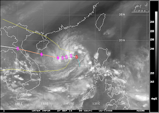
Water vapor with track overlay for Tropical Storm Wutip. Tropical
threat looming for Hainan, China and Vietnam next week.

EARTHQUAKES

  • There were no earthquakes rated at or above M6 yesterday or so far today.

SPACE WEATHER

  • SpaceWeather.com is declaring this solar max is the weakest in 100 years. Sunspots on the visible solar disk are turning away and pose no threats for strong solar flares.
"Weakest Solar Max in 100 years", says SpaceWeather.com

Thursday, September 26, 2013

9/26/2013 Daily Update: A Repeat for Thursday, Powerful 7.0 Earthquake Strikes Peru

Good morning everyone!

Weather has been on repeat in New England - sunny and dry for the foreseeable future. No precipitation in store until at least Tuesday. The coastal storm I talked about will likely stay out to sea.

TODAY: Sunny, with highs in the upper 60s to lower 70s. Winds from the N at 5 mph.

TONIGHT: Partly cloudy, with lows in the mid 40s. Light winds.

TOMORROW (FRIDAY!): Partly sunny, with highs in the upper 60s to lower 70s. Winds from the NW at 5 mph.


ATLANTIC TROPICS

  • Nothing exciting in the tropics

NATIONAL WEATHER

  • Beautiful weather with high pressure in the Northeast
  • Warm, with few storms in the Southeast
  • Very warm and sunny in the South and Midwest
  • Chilly with showers and elevation snows (!) for the mountains in the Northwest and Mountain West

WORLD WEATHER

  • Pabuk down to a tropical storm staying away from Japan
  • Powerful low pressure system about to cross Europe, with the first line of storms entering Western Europe
  • Storms that impacted Tasmania yesterday will cross the South Island of New Zealand

EARTHQUAKES

  • A powerful 7.0 earthquake struck Peru yesterday, on the heels of the massive 7.7 earthquake in Pakistan that created a new island. A few people are confirmed dead. http://earthquake.usgs.gov/earthquakes/eventpage/usb000jzma#summary
  • Definitely seeing a slight uptick in tremors in the last few days with the two 7-pointers in Peru and Pakistan

SPACE WEATHER

  • Flaring is at very low levels once again  with M-class flare chances back down to 1%. Largest sunspot is 1850 and has been showing signs of growth. That sunspot will be the focus if any flaring were to occur.
Solar activity continues to be at low levels.

Wednesday, September 25, 2013

9/25/2013 Daily Update: Fine Wednesday, Major 7.7 Earthquake Strikes Pakistan - Forms a New Island!

Good morning everyone!

Like the last few days, it's going to be a fine one again. No worries for your Wednesday.

TODAY: Sunny, with highs in the upper 60s to lower 70s. Winds from the N at 5 mph.

TONIGHT: A few clouds move in, with lows in the mid 40s. Light winds.

TOMORROW: Sunny, with highs in the upper 60s to lower 70s. Winds from the N at 5 mph.

A coastal storm comes near Southern New England around next Monday. So far, the models have been trending toward minimal to no impacts as the storm steers away from the region.


ATLANTIC TROPICS

  • Watching the piece of energy over Florida that should organize off the SE coast in the next couple days. Whether it will be tropical in nature is yet to be determined.

NATIONAL WEATHER
  • A treat for the Northeast with abundant sunshine and dry, seasonable weather
  • Tropical downpours and storms continue for the Southeast especially Florida
  • Very warm and dry in the South and Midwest
  • Dry in the Southwest
  • Showers in the Intermountain region, cooler air in the Northwest and West Coast

WORLD WEATHER

  • Typhoon Pabuk in the Western Pacific is no danger to Japan. It is a Category 2 moving away from the nation.
  • Showers in Northeast Europe
  • Rain for Southeast Australia as the system skids south

EARTHQUAKES

A new island appeared off the Pakistan coastline following a
large 7.7 earthquake. Redraw the world maps everyone.

SPACE WEATHER

  • The sun is on the quiet side in terms of solar flares but at least some signs of activity when a filament blasted away in the northeast quadrant sending a CME out to space. It is directed away from Earth.
  • M-class flare chances stand at 5% in the next 24 hours.

Tuesday, September 24, 2013

9/24/2013 Daily Update: Sunny Again, Potential for Storm to Start Next Week

Good morning everyone!

A little bit warmer than yesterday...nice for late September with temps into the upper 60s. Enjoy!

TODAY: Sunny with highs in the mid to upper 60s. Winds from the NW at 5 to 15 mph.

TONIGHT: Clear, with lows in the upper 30s to lower 40s. Light winds.

TOMORROW: Sunny, with highs in the upper 60s to lower 70s. Winds from the N at 5 to 10 mph.

Monitoring the possibility of an early-week storm to enter the month of October. Details early but could be one that runs up the coast bringing in tropical moisture. We'll see how models handle it in the coming days.


ATLANTIC TROPICS

  • The Atlantic is quiet but the remnants of 95L are currently drenching Florida and have a chance at organizing once it enters the waters of the SE coast.

NATIONAL WEATHER

  • Nice in the Northeast and Great Lakes
  • Numerous downpours affecting the Gulf states and Florida. Flooding is possible.
  • Mainly pleasant weather in the Midwest
  • Showers and storms in the Northwest
Tropical moisture induced storms impacting Florida.
Flood Watch for much of the state.

WORLD WEATHER

  • The lone tropical cyclone in the world, Typhoon Pabuk, in the Western Pacific is going to take a hard right away from Japan.
  • Slowly clearing out with showers moving northeast in Europe
  • Storms have been hammering New Zealand, while storms are keeping south of Australia

Pabuk stays away from Japan (Credit: Wunderground)

EARTHQUAKES

  • There were no earthquakes rated at or above M6 yesterday or so far today.

SPACE WEATHER

  • Same story - solar activity on the low side once again. Sunspots aren't particularly interesting. Solar wind speeds have risen signaling the approach of a coronal hole solar wind stream meaning auroras for the polar regions.

Monday, September 23, 2013

9/23/2013 Daily Update: Cool and Sunny Monday, Usagi Kills at Least 33 in Asia

Good morning everyone!

Cooler Canadian air arriving today... temperatures are going to top out only in the lower 60s. The trend is a slight warm-up back into the 70s after Monday, continuing the sunny and quiet weather. Should be dry the rest of the week.

TODAY: Cooler, sunny with highs in the upper 50s to lower 60s. Winds from the N at 5 to 15 mph.

TONIGHT: Clear skies, lows plummeting into the upper 30s. Frost may be possible. Winds turning calm.

TOMORROW: Sunny, with highs in the mid to upper 60s. Winds from the NW at 10 to 15 mph.


ATLANTIC TROPICS

  • Nothing to see here. Next...

NATIONAL WEATHER

  • Cool and dry for the Northeast and the Great Lakes
  • Storms along a stationary front in the Gulf Coast and Florida peninsula
  • Warmer air surging into Texas and the Midwest
  • Few showers east of the Colorado Front Range
  • Showers persist in the Northwest

WORLD WEATHER

  • Typhoon Usagi has killed at least 33 people in Asia and forced many evacuations in Southern China, which made landfall in Guangdong province north of Hong Kong. Recovery efforts are ongoing. http://www.usatoday.com/story/news/world/2013/09/23/typhoon-usagi-asia/2853191/
  • Pabuk is now considered a typhoon in the Western Pacific and looks to take a track out to sea away from the Japanese coastlines
  • Cloudy conditions dominating the continent of Europe, with showers in the northeast region
  • Few isolated showers in Southeast Australia, most action staying south out to sea.

EARTHQUAKES

  • There were no earthquakes rated at or above M6 yesterday or so far today.

SPACE WEATHER

  • Solar activity continues to be low nearing solar maximum. The sun has made occasional upticks to C-class range but none even near M-class. Sunspots are quiet. Action is in the coronal hole facing Earth that could spark a minor geomagnetic storm.

Sunday, September 22, 2013

9/22/2013 Daily Update: Great End to Weekend, Autumn Begins Today, Usagi Impacts Southern China

Good morning everyone!

Autumn begins at 4:44PM today and after rain last night, it will be a great end to the weekend! Going to be breezy but sunny for the rest of the day, with rich blue skies.

TODAY: Sunny, with highs in the mid 60s to lower 70s. Winds from the NW at 10 to 15 mph.

TONIGHT: Clear, with lows in the lower 40s. Winds from the NW at 5 to 10 mph.

TOMORROW: Cooler, with highs in the upper 50s to lower 60s. Winds from the N at 5 to 15 mph.

No rain chances in the foreseeable future... could finish the week without a single drop of rain.


ATLANTIC TROPICS

  • The Atlantic has become a snooze-fest. Moving on...

NATIONAL WEATHER

  • Cold front and showers have moved out, leaving behind a brisk NW wind and cooler air behind in the Northeast.
  • Storms drenching the Gulf Coast and Florida peninsula
  • Dry and warm for much of the central portion of the country
  • Storms possible for the Mountain West
  • Cool and showery in the Northwest

WORLD WEATHER

  • Typhoon Usagi has made landfall NE of Hong Kong in Southern China. This meant Hong Kong was speared the worst of the storm. The center of the typhoon tracked directly over Shanwei in Guangdong province and will continue to track inland bringing heavy rain, winds, and flooding. At least 2 people in the Philippines are dead, and 9 people injured after a tree fell on them in Taiwan. Poor timing for airline passengers as many flights were canceled in and out of Hong Kong and Macau following the end of the long Mid-Autumn Festival weekend.
  • Tropical Storm Pabuk, the storm that formed behind Usagi, is expected to swing NE, likely sparing the eastern coast of Japan.
  • High pressure over Europe is keeping out Humberto's remnants
  • A tornado touched down in New Zealand yesterday. Mainly showers and storms south of Australia.
Usagi is moving inland, delivering flooding threats to
Southern China (Credit: CIMSS)

EARTHQUAKES


SPACE WEATHER

  • Solar activity is low and sunspots are stable. A filament did erupt in the southwest corner of the sun but the CME was directed away from Earth. Solar wind from a Earth-facing coronal hole is expected to arrive Sept. 23-24.

Saturday, September 21, 2013

9/21/2013 Daily Update: Rain Arriving Tonight, Usagi on Course Toward Hong Kong, Analysis of Tropical Season so Far

Good morning everyone!

Mainly dry today with rain moving in the late afternoon and evening hours. It will turn breezy along with the cold frontal passage. Modest instability could trigger thunderstorms overnight, with pockets of heavy rain. Any plans today should be OK... it's tonight when it turns wet. Rain clears after Sunday morning.

TODAY: Partly sunny with showers in the late afternoon and evening hours. Highs in the lower to mid 70s. Winds from the S at 10 to 15 mph with gusts near 30 mph.

TONIGHT: Heavy rain and a chance of thunderstorms with lows in the lower 60s. Winds from the S at 5 to 10 mph with gusts as high as 20 mph.

TOMORROW: Showers and storms in the morning, clearing out by the afternoon and turning sunny. Highs in the mid to upper 60s. Winds from the NW at 5 to 15 mph.

Cooler Monday, temps only in the lower 60s but turning more seasonable by the middle of next week.


ATLANTIC TROPICS

  • A lull in the action in the Atlantic. Only main feature is the wave east of Bermuda but it is about to enter cooler waters and is out to sea anyways. Chances of development are minuscule.
  • With activity on the low side, I ask the question... so how are we doing? Our last named storm was Ingrid, which was the 9th storm of the season. But only two hurricanes so far and they were the last two storms (Humberto and Ingrid). Not to mention they were barely above hurricane status. Based on the chart below, by September 21st, an average season would have 7 named storms, 4 hurricanes, and 1 major hurricane. We are slightly above normal for named storms (9), but below normal for hurricanes (2) and well below if you take ACE (Accumulated Cyclone Energy) into factor. However, even though the season has been fairly tame, don't tell that to Mexico. In what is becoming one of the nation's worst flooding disasters in history, it's fortunate there aren't more intense storms this season. It could very well be much worse. Goes to show even tropical storms and minimal hurricanes can be devastating, especially in an area vulnerable like Mexico. 2013 may be quiet in terms of activity, but it sure hasn't as far as impacts go.
Average Atlantic season by named systems, hurricanes, category
3 or greater (Credit: NOAA)

NATIONAL WEATHER

  • Heavy rain and storms in the East Coast along a cold front stretching all the way from Canada to the Gulf. Pretty impressive structure.
  • Storms along the Gulf Coast, taking advantage of tropical moisture.
  • Dry and warm for the Plains, cooler behind the cold front in the Great Lakes region
  • Cooler with chances of showers in the Northwest

WORLD WEATHER

  • Super Typhoon Usagi affecting Taiwan and the Philippines, passing south of Taiwan into the South China Sea. It is expected to directly hit Hong Kong as a strong typhoon. This is a serious storm producing major storm surges, winds, and rainfall so it's good there have been no reports of serious casualties or damage so far. Let's keep it this way... this was anticipated days in advance, about a week if you're a weather geek. ;) (Take a look at the World Weather section, 3 bullets down on the 9/15/2013 Update: http://westernmaweather.blogspot.com/2013/09/9152013-daily-update-sunny-sunday.html)
  • Another storm in the Western Pac, Tropical Storm Pabuk forms well southeast of Japan but could come near the island nation by middle of next week.
  • Low over Europe delivering clouds and showers especially in eastern Europe
  • High pressure continues its dominance in inland Australia, with showers isolated in Southeast Australia.
On path toward Hong Kong by Monday, a Category 1 or 2
typhoon by then (Credit:  Joint Typhoon Warning Center)

EARTHQUAKES


SPACE WEATHER

  • The sun is slowly becoming more active and is producing low-level C-flares now. Still low activity by all means... the main sunspot to look out for is 1850 in the eastern side of the sun turning toward Earth. M-class flare chances today: 5%
Sunspot 1850 is responsible for the recent
C-class flares (Credit: SpaceWeather.com)

Friday, September 20, 2013

9/20/2013 Daily Update: A Dandy Friday, Strongest Typhoon of 2013 Set to Impact Tomorrow, Earthquake Near Fukushima

Good morning everyone!

It's Friday, the last Friday of Summer 2013! And it will be another dandy with rich, blue skies and warm temperatures. Enjoy!

TODAY: Sunny with highs in the mid 70s to near 80 degrees. Winds from the S at 5 mph.

TONIGHT: Clouds on the increase with lows in the lower to mid 50s. Winds from the S at 5 mph.

TOMORROW: Partly cloudy with highs in the lower to mid 70s. Turning breezy, with winds from the S at 5 to 15 mph, with gusts over 20 mph possible.

Rain enters Saturday night and could be heavy at times. Also, a slight chance of thunderstorms overnight is possible. Rain should clear after Sunday morning and a dry second half of the day expected. Cooler by Monday.


ATLANTIC TROPICS

  • As seen yesterday, Invest 95L has become less organized in the Bay of Campeche. The system should stay there for the next few weeks due to lack of steering currents. It is causing moisture to spread into the South, producing heavy rain for drought-stricken regions like Texas, Louisiana which is very good news.
  • An area of interest east of the Bahamas has a low chance of development in the next 48 hours.

NATIONAL WEATHER

  • Warm in the Northeast with rain and storms approaching from the west
  • Mostly dry and humid in the Southeast
  • Widespread heavy rain for the South, especially Texas from tropical moisture
  • Warmer in the Mountain West and the Intermountain West region
  • Warm for the Northwest with rain offshore

WORLD WEATHER

  • Strongest typhoon of 2013, Super Typhoon Usagi, is closing in on southern Taiwan, set for impact tomorrow. Also, being affected is northern Philippines. The dangerous storm is about to enter the South China Sea where it could hit Hong Kong. Evacuations are ongoing.
  • Manuel has moved on inland and dissipated over western Mexico
  • Rain chances for Europe with the low over the continent
  • Cold front producing shower and storms for southern Western Australia
Water vapor of Super Typhoon Usagi with growing concerns
of impacts to Southeast Asia

EARTHQUAKES

  • A strong 5.3 earthquake struck near Fukushima yesterday. Officials say no damage was caused to the Fukushima nuclear plant.
  • There were no earthquakes rated at or above M6 yesterday or so far today.

SPACE WEATHER

  • A faint CME was produced in the southeast quadrant of the sun yesterday but it is not expected to hit Earth directly. Even if it did, it should have minimal impacts to Earth.
  • Sunspots lined up on the eastern side of the Sun but all remains quiet and stable. M-class flare chances set at 5% for the next 24 hours.

Thursday, September 19, 2013

9/19/2013 Daily Update: Delightful Thursday, Usagi Rapidly Intensifies - Becomes a Category 5 Beast

Good morning everyone!

Delightful day in the making... five stars all around. Go outside and enjoy!

TODAY: Sunny, with highs in the mid 70s to around 80 degrees. Light winds from the south.

TONIGHT: Clear skies, with lows in the mid to upper 40s. Light winds.

TOMORROW (FRIDAY!): Sunny, with highs in the mid 70s to around 80 degrees. Winds from the S at 5 mph.

The weekend should feature the arrival of showers Saturday night into Sunday. Sunday does not look good... going to be raining in the morning hours into the early afternoon. Hoping we can savor part of the afternoon and evening. From there... back to sunny and seasonable weather next week.


ATLANTIC TROPICS

  • The waves keep on churning in the Bay of Campeche. The latest is Invest 95L with an opportunity to develop. However, unlike the previous storms, Invest 95L faces an uphill climb with shearing in place left from Ingrid. Going to be tough for 95L to strengthen unless conditions improve.
  • Humberto, now a tropical depression, is about to leave the scene, become post-tropical and move out of here.

NATIONAL WEATHER

  • Warmer air arriving in the Northeast
  • Mostly dry and warm in the Southeast with a few isolated storms possible especially along the coast of Florida.
  • Severe storms for parts of the Upper Midwest and Central Plains with a strong cold front pushing into the region with cooler air behind it.
  • Rain and stormy in Texas triggered by an influx of tropical moisture
  • Warm, dry in the West Coast

WORLD WEATHER

  • Usagi in the Western Pacific underwent rapid intensification yesterday and blew up to become the first Category 5 tropical cyclone in 2013, beating Utor for strongest with maximum sustained winds of 160 mph vs. 120 mph for Utor. Taiwan is in great danger for impact as Usagi's path takes it near the southern part of the island by the weekend.
  • Manuel is back to hurricane status along the Gulf of California in the Eastern Pacific and is putting a stranglehold there. Big rains and winds for the next several days.
  • Cloudy and dreary with rain chances for much of Europe
  • Rain keeps on coming for Victoria and Tasmania in Australia
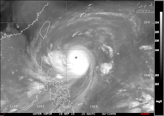
Usagi is a 10. Look at that eye! WOW!

EARTHQUAKES

  • There were no earthquakes rated at or above M6 yesterday or so far today.

SPACE WEATHER

  • Solar wind speed uptick could cause a minor geomagnetic storm.
  • Solar activity remains low but signs of life showing with two C-class flare events in the last 24 hours. There is a small threat for an M-class flare. Percentages bumped up to 5%.
Solar activity still low.
5% chance of a solar flare in next 24 hours.

Wednesday, September 18, 2013

9/18/2013 Daily Update: Warming Trend into Friday, Sun Waking Up

Good morning everyone!

Another cool start to the day, but turning warmer than yesterday into the 70s by the afternoon.

TODAY: Sunny, with highs in the upper 60s to lower 70s. Winds from the S at 5 to 10 mph.

TONIGHT: Clear, with lows in the lower 40s. Calm winds.

TOMORROW: Sunny and warmer, with highs in the lower to upper 70s. Winds from the SW at 5 to 10 mph.

We steadily warm up each day... could break 80 degrees on Friday!


ATLANTIC TROPICS

  • High chances of development in the Yucatan Peninsula. This has been a hotspot for formation all season. NHC gives chances at 70% in the next 48 hours.
  • Tropical Storm Humberto in the northern Atlantic moving out to sea.
Tropical wave in the Yucatan with a high chance of developing

NATIONAL WEATHER

  • Nice weather in the Northwest with high pressure overhead
  • Generally fair weather for the Southeast with exception of storms in Florida and the Tennessee Valley
  • Hot in the South and the Midwest
  • Chance of strong to severe storms in the Mountain West and the Northern Plains today
  • Drier conditions for the Northwest

WORLD WEATHER

  • Tropical Storm Usagi in the Western Pacific is one to watch with expectations of strengthening and on course to impact Taiwan as a strong typhoon.
  • A tropical depression along the coast of central Vietnam drenching the nation.
  • Manuel still being classified as a depression as he meanders in the Baja Mexico Peninsula
  • Storms in much of continental Europe from several low pressure systems
  • Same story with most showers staying in Southeast Australia

EARTHQUAKES

  • There were no earthquakes rated at or above M6 yesterday or so far today.

SPACE WEATHER

  • The sun is alive finally when a C3.9 solar flare blasted from the newcomer Sunspot 1846 on the sun's eastern limb. More sunspot regions have been numbered as well. Things may be picking up... we'll have to see. M-class flare chances, though, remains at 1%.
Solar activity still quiet but signs of life brewing

Tuesday, September 17, 2013

9/17/2013 Daily Update: Autumn Feel in the Air, Typhoon Threat in Taiwan This Weekend

Good morning everyone!

Certainly a cold and frosty morning out there with widespread 30s in Western Mass. Today should see temperatures rebound into the 60s, definitely going to feel like early autumn!

TODAY: After a cold morning, it will be sunny with highs in the lower to mid 60s. Winds from the N at 5 to 10 mph.

TONIGHT: Calm winds and clear skies are going to plummet temps again. Lows in the mid to upper 30s. Wouldn't be surprised to see areas hover around the freezing mark.

TOMORROW: Slightly warmer, sunny with highs in the upper 60s to lower 70s. Winds from the SW at 5 to 10 mph.

The dry and sunny stretch lasts into the weekend.


ATLANTIC TROPICS

  • Ingrid has dissipated after making landfall near north of Tampico, Mexico causing deadly floods and landslides. The death toll with combined with Manuel has increased into the 30 and 40 range.
  • An area of convection in the Yucatan Peninsula is being monitored for potential development. NHC marks the area with a 20% chance of forming into a tropical cyclone in the next 48 hours.
  • Humberto has indeed reformed back into a tropical storm and continues his lonely trek in the North Atlantic Ocean.
More rain for Mexico like they need anymore...

NATIONAL WEATHER

  • Cool and autumn feel in the Northeast
  • Cool and dry weather north of the stationary front parked over the South, storms and moist air south of there
  • Scattered storms across the Midwest, heavy rain for extreme Southern Texas from Ingrid
  • Milder air over the Northern Plains and Upper Midwest
  • Cool and showery in the Northwest today, cool marine air in Southern California

WORLD WEATHER

  • Western Mexico dealing with the remnants of Manuel. The damage has been done though.
  • Newly-formed Tropical Storm Usagi in the Western Pacific is going to explode into a typhoon as it heads toward Taiwan. That is the one consistently being models over the last days. Another big storm for them... watch out.
  • Showers and storms in the forecast for the U.K. and much of Europe
  • Heavy rain along the coastlines of south-central and southeast Australia. A trough is also producing showers over in northwest Australia
Tropical cyclone threat for Taiwan and China

EARTHQUAKES

  • Active region of earthquakes in Eastern Europe. Greece was hit by a 5.3 earthquake and Georgia by a 5.4 earthquake yesterday.
  • There were no earthquakes rated at or above M6 yesterday or so far today.
Earthquake tremors in Greece and Georgia with two M5+ recorded

SPACE WEATHER

  • A new sunspot is turning in toward Earth. Hoping this one can produce something unlike its latest predecessors.
  • Only one sunspot in the central solar disk and it is stable. Where is solar max?
  • Very subtle disturbance in the proton flux from a coronal hole.
Hoping this puppy can turn things around...

Monday, September 16, 2013

9/16/2013 Daily Update: Few Showers Around Today, Double Hit on Mexico with Ingrid and Manuel, Man-yi Impacts Japan

Good morning everyone!

A few showers are around mainly for the morning and early afternoon hours and a chilly night following.

TODAY: Scattered showers and mostly cloudy skies with highs in the lower to mid 60s. Winds from the N at 5 to 10 mph.

TONIGHT: Decreasing clouds with lows in the mid 30s to lower 40s. Areas of frost possible especially in the hilltowns and Berkshires. Winds from the N at 5 to 10 mph.

TOMORROW: After a cold and frosty morning, it will be sunny with temps rebounding into the mid 60s. Winds from the N to NE at 5 to 10 mph.


ATLANTIC TROPICS

  • Ingrid made landfall as a borderline hurricane in the eastern Mexican coastline north of Tampico causing flash flooding leading to evacuations. Along with Manuel with struck the other side of Mexico simultaneously, they forced Mexican Independence Day activities to be canceled that were to be held on Sunday and Monday. Both of these systems claimed at least 21 lives, possibly more. http://science.time.com/2013/09/15/hurricane-ingrid-tropical-storm-manuel-threaten-mexico/
  • Humberto could reform again as the storm heads toward the Northern Atlantic.
GOES Rainbow IR of Ingrid and Manuel both impacting
Mexico at the same time.

NATIONAL WEATHER

  • Showers around and cool in the Northeast
  • Heat lingers in the South and Southeast with scattered storms possible along the coast
  • Cooler and dry across the Upper Midwest, storms in the central portion of the country
  • Storm activity starting to dissipate in the Mountain West and Southwest regions. Good news for Colorado who has been dealing with massive flooding.
  • Storms along a cold front that affected the Northwest and delayed the Sunday Night Football game yesterday have moved eastward. Mostly dry with a few showers in the forecast.

WORLD WEATHER

  • Tropical Storm Manuel made landfall in southwest Mexico and combined with Ingrid produced flooding and landslides, killing at least 21 people. See the Atlantic tropics section for a link.
  • Tropical Storm Man-yi impacted central Japan and hundreds of thousands of people evacuated ahead of the storm. At least 2 deaths were being reported. I don't know why most links title it "Typhoon Man-yi", it was close to typhoon status, but it was under the criteria. Never was a typhoon during the duration of the storm's life. Anyways, just bear in mind it did not strike Japan as an actual typhoon but strictly a "strong to severe" tropical storm: http://www.japantimes.co.jp/news/2013/09/16/national/typhoon-man-yi-makes-landfall-warnings-issued-in-western-japan/#.UjcEN8bB37o
  • Rain showers and storms over much of Europe with a powerful low pressure system north of the U.K.
  • Severe thunderstorms affecting Southeast Australia, showers in the southwest.

EARTHQUAKES


SPACE WEATHER

  • Solar wind speeds are expected to increase from a geoeffective coronal hole. Minor geomagnetic activity possible.
  • Let's just forget about the sun, shall we? You know the drill...

Sunday, September 15, 2013

9/15/2013 Daily Update: Sunny Sunday, Ingrid Becomes Second Hurricane of Season

Good morning everyone!

Sunday should feature more sun than clouds... going to be a nice day!

TODAY: Sunny with highs in the mid 60s to lower 70s. Winds from the SW at 5 to 10 mph.

TONIGHT: Partly cloudy with lows in the mid 40s to lower 50s. Winds from the SW at 5 mph.

TOMORROW: Mostly cloudy with a few showers possible. Highs in the mid 60s to near 70 degrees. Winds from the NW at 5 to 10 mph.

After some showers on Monday, things are looking sunny and dry through most of the week.


ATLANTIC TROPICS

  • Ingrid becomes the 2nd hurricane of the Atlantic hurricane season with sustained winds of 85 mph moving west toward Tampico, Mexico. Hurricane Warnings are up for the area. Flooding and landslides causing damage is inevitable. Rainfall forecasts are calling for 10-20" of rain. Eastern Mexico has already been hit by tropical cyclones this season with Barry, Fernand, and Tropical Depression Eight, but Ingrid is the strongest of them four. Hope for the best, prepare for the worst.
  • Remnants of Humberto is entering a less-sheared environment and could reform back as he heads north in the northern Atlantic. Should not be a threat to land but could become a powerful extratropical low once he reaches Iceland.
Water vapor of Hurricane Ingrid along the Mexican coastline

NATIONAL WEATHER

  • Nice conditions in the Northeast today
  • Scattered storms for the Gulf Coast and Southeast aided by tropical moisture
  • Storms for the Southwest and for central portions of the country along a stalled front
  • Warmth and rain entering the Northwest

WORLD WEATHER

  • Tropical Storm Manuel is a strong tropical storm near hurricane status with winds clocking at 70 mph and set to make landfall in western Mexico around Guadalajara. It's a one-two punch for Mexico with Ingrid affecting the other side of the nation.
  • Tropical Storm Man-yi is about to make landfall in central Japan, expecting to bring heavy rain and winds. Its path takes it near Fukushima, the site of the damaged nuclear reactor in the 2011 mega Japan earthquake.
  • Models have been developing a typhoon that will impact Taiwan in 5-6 days. Keeping an eye on that.
  • The European radar below showing showers in the U.K. and central portions of Europe.
  • Mainly showers over Southeast Australia
Radar of Europe at 12:00 UTC

EARTHQUAKES

  • There were no earthquakes rated at or above M6 yesterday or so far today, making it 8 straight days without one.

SPACE WEATHER

  • Solar weather remains pitiful and quiet for the time being. M-class flare chances are very low at 1% in the next 24 hours.

Saturday, September 14, 2013

9/14/2013 Daily Update: Fine Weekend Ahead; Tampico, Mexico Alert for Ingrid

Good morning everyone!

Today will feature sunshine and a brisk wind from the north. Should remain dry and sunny for the weekend.

TODAY: Mostly sunny with highs in the upper 60s to lower 70s. Winds from the N at 5 to 15 mph.

TONIGHT: Clearing skies, with lows in the lower to mid 40s. Winds becoming light.

TOMORROW: Mostly sunny with highs in the upper 60s to lower 70s. Winds from the SW at 5 to 10 mph.

Overall, a fine weekend with a touch of autumn in the air!


ATLANTIC TROPICS

  • Main story today is Ingrid along the Mexican coast, forecasted to strengthen into a hurricane in the next 2 days and make landfall near Tampico which should be on high alert for heavy rain, flash flooding, and mudslides. And winds, of course.
  • Humberto has turned post-tropical in the latest update, could reform back but staying out to sea.
  • Gabrielle is now post-tropical what is left of her is heading toward Nova Scotia and bring heavy rain, flooding.
Ingrid should strengthen into a hurricane by the end of
the weekend.

NATIONAL WEATHER

  • Cool, sunny, dry in the Northeast
  • Most of the South and Southeast north of a stationary front will be comfortable, while south of there is humid and stormy.
  • Warm weather for Texas, lesser humidity in the Midwest
  • More moisture could spark storms in the Southwest, Mountain West, and Northern Plains
  • Warm and dry in the Northwest

WORLD WEATHER

  • Tropical Storm Manuel is the lucky 13th tropical cyclone of the Eastern Pacific season and is expected to bring tropical storm-force winds and make landfall around Jalisco, Mexico. A dual-threat with accomplice Ingrid in the Atlantic.
  • Tropical Storm Man-yi in the Western Pacific is heading for Japan in the next 2 days.
  • Low over Europe dictating the showers and storms in the central portions of the continent
  • Isolated showers in Southeast Europe and southern Western Australia
Man-yi destined for Japan

EARTHQUAKES

  • Of course, there were no earthquakes rated at or above M6 yesterday or so far today.

SPACE WEATHER

  • Quiet sun which has been the case for the last week. Sunspots are stable and not flaring at all.
Depressing stuff and quite sad really...

Friday, September 13, 2013

9/13/2013 Daily Update: Much Cooler and Decreasing Humidity Friday, Colorado Flooding, Tropical Depression 10 Forms

Good morning everyone and Happy Friday!

It's finally becoming cooler and drier after two days of late-seasonal heat and storms. Going to be right around average for this time of year today.

TODAY: Showers in the morning then turning mostly sunny in the afternoon with highs in the lower to mid 70s. Winds from the NW at 5 to 15 mph.

TONIGHT: Partly cloudy with lows in the mid to upper 40s. Winds from the NW at 5 to 10 mph.

TOMORROW: Mostly sunny with highs in the upper 60s to around 70. Winds from the NW at 5 to 10 mph.

A gem of a weekend ahead with comfortable temperatures and sunshine!


ATLANTIC TROPICS

  • Tropical Depression Ten has formed in the Bay of Campeche and is going to bring some heavy rain and flooding for Mexico, around the same area of where Barry and Fernand formed.
  • Hurricane Humberto out in the Eastern Atlantic poses no threat to land and should remain out to sea.
  • Tropical Depression Gabrielle is moving north and destined for Nova Scotia, Canada; most likely post-tropical by then.

NATIONAL WEATHER

  • Major flooding in Colorado yesterday. Three people dead and one missing and many displaced after 6 to 7 inches of rain fell in less than 24 hours. The worst hit was around Boulder County, Colorado. Rescues had to be made. Thoughts and prayers to those affected: http://www.cnn.com/2013/09/12/us/flooding-colorado/?hpt=us_c2
  • Cold front is moving out and bringing in refreshing and more seasonable air for the Northeast
  • Hot and humid for the South and Southeast
  • Cooler and pleasant in the Midwest
  • Scattered storms again in the Southwest and Mountain West
  • Very warm and dry in the Northwest

WORLD WEATHER

  • Tropical Storm Man-yi in the Western Pacific could take a slash at Japan near Tokyo sometime next week
  • Showers and storms continue for most of Europe
  • Low pressure triggering showers and storms in Southeast Australia

EARTHQUAKES

  • There were no earthquakes rated at or above M6 yesterday or so far today, yet again.

SPACE WEATHER

  • Yawning at the Sun... solar activity remains eerily quiet in the solar maximum year. M-class flare chances at 1%.

Thursday, September 12, 2013

9/12/2013 Daily Update: Strong to Severe Storms Possible Today, Cooler by Tomorrow

Good morning everyone!

Hot yesterday with many regions saw temperatures rising above 90 degrees and the humidity made it feel like it was above 100! Here were high temperatures from official stations:

Springfield/Chicopee: 95°
Westfield: 95°
North Adams: 92°
Orange: 92°
Pittsfield: 90°

Storms passed through last night and dealing with another potential for strong to severe storms in the afternoon before things calm down and it turns much cooler heading into the weekend + refreshing!

TODAY: Showers and thunderstorms in the afternoon, a few of which could be strong to severe. Highs in the lower to mid 80s. Winds from the SW at 5 to 15 mph.

TONIGHT: Showers and storms in the evening, then decreasing late. Lows around the mid 60s. Winds from the S at 5 mph.

TOMORROW: Cooler, with partly cloudy skies, highs in the lower to mid 70s. Winds from the N at 5 to 15 mph.


ATLANTIC TROPICS

  • Hurricane Humberto maintains hurricane status in the Eastern Atlantic far away from land.
  • Gabrielle is now a depression but could strengthen back up as a tropical storm as she heads north.
  • High potential for a tropical cyclone in the Bay of Campeche which will impact Mexico again. Next name on the list is Ingrid.
  • Ex-98L is still being watched although it is small in size with little convection.

NATIONAL WEATHER

  • Strong to severe thunderstorms ahead of a cold front for the Northeast today
  • Humid and very warm across the South and Southeast with isolated storms
  • Storms that could pose flooding risks out in the Southwest and Mountain West region
  • Pleasant and cooler weather for the Northern Plains and Midwest region
  • Unseasonably warm and dry in the Northwest

WORLD WEATHER

  • Low pressure system over Germany producing showers and storms for central Europe
  • A line of storms went through New Zealand yesterday. Rain/storms for Southeast Australia today.

EARTHQUAKES

  • There were no earthquakes rated at or above M6 yesterday or so far today.

SPACE WEATHER

  • Additional sunspots have appeared but all looks stable and quiet. Geomagnetic activity is normal. M-class flare chances at 1% for the next 24 hours.

Wednesday, September 11, 2013

9/11/2013 Daily Update: Summer Heat Today, Humberto Becomes First Hurricane of Season

Good morning everyone!

Going to be a hot day outside and it will definitely feel like mid-July!

TODAY: Sunny, hot and humid, with highs in the lower to mid 90s. Winds from the SW at 5 to 10 mph.

TONIGHT: A chance of thunderstorms and mostly cloudy with lows in the mid to upper 60s. Heavy rain possible in any thunderstorms. Winds from the S at 5 mph.

TOMORROW: Showers and thunderstorms in the afternoon, a few of which could be strong to severe. Highs in the lower to mid 80s. Winds from the S at 5 to 15 mph.

The threat for severe weather exists tomorrow before a cold front pushes in cooler air for Friday and the weekend.


ATLANTIC TROPICS

  • Humberto becomes the first hurricane of the 2013 Atlantic hurricane season at 5 AM just a few hours before the latest first hurricane record in 2002 at 8 AM. He is expected to move north then as the NHC suggests, take a sharp turn to weak and weakening to a tropical storm with drier air to the north.
  • Gabrielle has made a close pass at Bermuda and is expected to move north toward Nova Scotia in the next 3 days, staying hundreds of miles off the New England coast.
  • Steady development for the tropical wave in the Yucatan peninsula where models suggest it impacting Mexico again.
  • Ex-Invest 98L is displaying resilience with NHC tagging it with a 10% yellow circle. Something to watch in the future though, with the latest 0z ECMWF strengthening it near the Bahamas in a week's time.
The tropics are in full swing in time for peak of season.

NATIONAL WEATHER

  • Hot and humid for the Northeast today with storms especially to the west and north
  • Very warm weather for the Southeast with storms around
  • Showers and storms for the Southwest
  • Drier and cooler weather for the Northern Plains
  • Hot for the Northwest


WORLD WEATHER

  • Showers for parts of Northern Europe today.
  • Showers and storms for southern parts of Australia

EARTHQUAKES

  • There were no earthquakes rated at or above M6 yesterday or so far today.

SPACE WEATHER

  • A prminence erupted of the sun hurling a CME to space but it is headed south of Earth
  • Great article from SpaceWeather.com - it does indeed seem like solar minimum with barely any sunspots forming. But it could be just a lull, and the sun could start waking up by the end of the year in time for solar max.

Tuesday, September 10, 2013

9/10/2013 Daily Update: Turning Warmer Today, Gabrielle Redevelops, Humberto Strengthening

Good morning everyone!

Summer heat is returning and humid air as well as heat from the Midwest moves east into New England. Wednesday could be one of the hottest days we've seen this year with temps into the lower to mid 90s and dewpoints above 70 degrees. Thankfully, the stifling heat lasts for only one day and we quickly cool back down for next weekend but not before a powerful cold front passage triggering strong to severe thunderstorms on Thursday.

TODAY: Mostly cloudy and warmer with highs in the lower to mid 80s. Seeing thunderstorms to the west in NY state that will bring chances of storms and heavy rain in the morning hours. Winds from the SW at 5 to 15 mph.

TONIGHT: Chance of a storm in the evening, otherwise partly to mostly cloudy with lows in the mid 60s. Winds from the S at 5 to 10 mph.

TOMORROW: Hot, hazy, and humid. Highs into the 90s, mid 90s especially in the valleys and lower elevations. An isolated shower or storm is possible. Winds from the SW at 5 to 10 mph.

Threat of severe weather on Thursday which needs to be watched closely.


ATLANTIC TROPICS

  • Gabrielle has reformed and Tropical Storm Warnings are up for the island of Bermuda. Her track takes her north then northeast away from New England, impacting Nova Scotia as a post-tropical storm.
  • Humberto is gaining strength and is expected to be a hurricane later today. If true, the record for the latest hurricane on record (September 11 in 2002) won't be broken. Sustained winds are up to 65 mph and is heading away from the Cape Verde Islands into open waters.
  • A disturbance in the NW Caribbean Sea is bring modeled to develop into a tropical cyclone around 5 days from now and takes it in the Bay of Campeche again impacting Mexico and possibly as north as Southern Texas.
  • NOTE: Today is the climatological peak of the Atlantic hurricane season and it does feel like it!

NATIONAL WEATHER

  • Heat and storms upcoming for the Northeast
  • Warmth and heat over the eastern half of the country
  • Scattered storms in the Great Lakes region
  • Humid and storms possible for the Southwest
  • Dry and warm along the West Coast

WORLD WEATHER

  • Storms for central Europe today
  • Front bringing showers for Victoria and Tasmania in Australia

SPACE WEATHER

  • The sun sure seems to be sleeping nearing solar maximum with hardly a sunspot on the visible solar disk. Don't know what's going on. M-class flare chances are at 1%.
The sun is almost spotless...

Monday, September 9, 2013

9/9/2013 Daily Update: Warming Up + Sunny Monday, Humberto Forms in the Atlantic (First Hurricane of Season Finally?)

Good morning everyone!

Hope you enjoyed the weekend. It's a cool start this morning but it gets warmer by the afternoon with dry conditions prevailing.

TODAY: Sunny, with highs in the upper 60s to lower 70s. Winds from the SW at 5 to 10 mph.

TONIGHT: Clouds on the increase, with lows in the lower to mid 50s. Winds from the S at 5 mph.

TOMORROW: Partly to mostly cloudy skies with a small chance of an isolated shower or storm. Warmer with highs reaching into the 80s. Winds from the S at 5 to 15 mph.

A warm-up is expected midweek and temperatures could rise to 90 degrees on Wednesday! It will definitely feel like summer in the middle of July. With the hotter weather comes the chance for scattered showers and thunderstorms, a few of which could be strong to severe. Watching the potential closely as it gets near. Small shot at storms Tuesday (mostly Northern New England), and Wednesday and Thursday for Southern New England.


ATLANTIC TROPICS

  • The NHC has upgraded the tropical wave in the Eastern Atlantic to Tropical Storm Humberto, the 8th named storm of the season. Near-term effects for the Cape Verde islands, long-term - could turn out to be the first hurricane of the season as it heads W-NW. NHC is pretty optimistic on this one and so are the models. Going to come close to the September 11th latest hurricane record. In fact, NHC has Humberto becoming a hurricane at EXACTLY September 11th...
  • Remnants of Gabrielle is not posing much of a threat for the near future. Low chances of development in the next 5 days. Besides Bermuda who is directed on her path, she should just be a surf-maker for the East Coast.
Newly-formed Tropical Storm Humberto in the Eastern Atlantic and the remnants
of Gabrielle in the north Caribbean

NATIONAL WEATHER

  • Pleasant weather for the Northeast
  • Isolated storms for the Southeast, otherwise hot and dry
  • Heat continues for the Midwest and the South
  • Storms in the Northern Plains and Great Lakes with the low moving over the area
  • Flooding threat for the Southwest with tropical moisture feeding in
  • Dry for the Northwest and West Coast

WORLD WEATHER

  • Rain for Western and Central Europe
  • Southeast Australia is being drenched

EARTHQUAKES

  • There were no earthquakes rated at or above M6 yesterday or so far today.

SPACE WEATHER

  • Another coronal hole expected to face Earth by the end of the week.
  • All quiet with the sun with sunspots few and far between. M-class flare chances have dropped to a meager 1%.
Unimpressive sun with only 2 spots - solar
activity is very low

Sunday, September 8, 2013

9/8/2013 Daily Update: Not Bad for Your Sunday, Freak Hailstorm Hits the U.K.

Good afternoon (noon) everyone!

After a few showers last night, we should be mainly dry and sunny today. Can't rule out a spot shower but that is it. Enjoy your Sunday!

TODAY: Sunny, with a small chance of an isolated shower. Highs at or around 70 degrees. A bit breezy with N winds at 5 to 15 mph, gusting over 20 mph at times.

TONIGHT: Clear skies and another cool one, with lows plummeting into the upper 30s to lower 40s. A Frost Advisory is out for Northern Berkshire County. Winds will be calm.

TOMORROW: Sunny with highs in the upper 60s to lower 70s. Winds from the SW at 5 to 10 mph.


ATLANTIC TROPICS

  • Highest chance of development is along the Eastern Atlantic near the Cape Verde islands. NHC is quite confident with a 70% chance of development in the next 48 hours, 90% in the next 5 days. If it develops, the system would be named Humberto.
  • The remnants of Gabrielle is located in the northern Caribbean Sea. Doesn't look organized on satellite as it moves north and so has a low chance of reforming.
  • NOTE: The date of the latest forming hurricane on record is September 11th, 2002 with Hurricane Gustav. Going to be interesting to see whether the wave in the Eastern Atlantic can develop into a hurricane before September 11th as models are latching onto it forming into a strong tropical storm/hurricane recurving.

NATIONAL WEATHER

  • Cold front moving across the Northeast with showers chances
  • High pressure over the Southeast is ushering in warm air and keeping things dry for the most part but storms still possible along the coastlines.
  • The heat wave continues for the Midwest and the heart of the country.
  • Showers and storms for the Southwest and the Mountain West states from Lorena's moisture.
  • Dry and warm across the Northwest and West Coast

WORLD WEATHER


EARTHQUAKES

  • An uptick in activity over Europe with a 5.0 in Greece and a 4.6 in Romania.
  • There were no earthquakes rated at or above M6 yesterday or so far today.

SPACE WEATHER

  • A coronal hole is expected to turn toward Earth and bump solar wind speeds and disturb the geomagnetic field tomorrow.
  • Quiet sun, flaring is low, and there are only 3 sunspots on the visible solar disk. M-class flare chances are low at 5% in the next 24 hours.