Sunday, September 8, 2013

9/8/2013 Daily Update: Not Bad for Your Sunday, Freak Hailstorm Hits the U.K.

Good afternoon (noon) everyone!

After a few showers last night, we should be mainly dry and sunny today. Can't rule out a spot shower but that is it. Enjoy your Sunday!

TODAY: Sunny, with a small chance of an isolated shower. Highs at or around 70 degrees. A bit breezy with N winds at 5 to 15 mph, gusting over 20 mph at times.

TONIGHT: Clear skies and another cool one, with lows plummeting into the upper 30s to lower 40s. A Frost Advisory is out for Northern Berkshire County. Winds will be calm.

TOMORROW: Sunny with highs in the upper 60s to lower 70s. Winds from the SW at 5 to 10 mph.


ATLANTIC TROPICS

  • Highest chance of development is along the Eastern Atlantic near the Cape Verde islands. NHC is quite confident with a 70% chance of development in the next 48 hours, 90% in the next 5 days. If it develops, the system would be named Humberto.
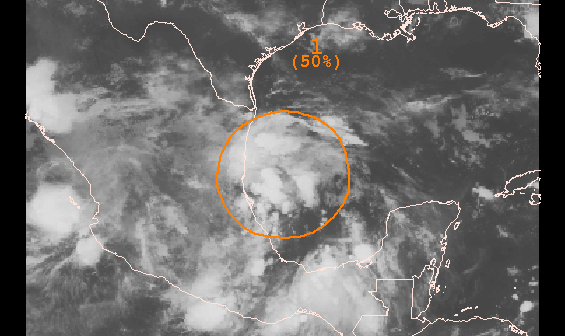
  • The remnants of Gabrielle is located in the northern Caribbean Sea. Doesn't look organized on satellite as it moves north and so has a low chance of reforming.
  • NOTE: The date of the latest forming hurricane on record is September 11th, 2002 with Hurricane Gustav. Going to be interesting to see whether the wave in the Eastern Atlantic can develop into a hurricane before September 11th as models are latching onto it forming into a strong tropical storm/hurricane recurving.

NATIONAL WEATHER

  • Cold front moving across the Northeast with showers chances
  • High pressure over the Southeast is ushering in warm air and keeping things dry for the most part but storms still possible along the coastlines.
  • The heat wave continues for the Midwest and the heart of the country.
  • Showers and storms for the Southwest and the Mountain West states from Lorena's moisture.
  • Dry and warm across the Northwest and West Coast

WORLD WEATHER


EARTHQUAKES

  • An uptick in activity over Europe with a 5.0 in Greece and a 4.6 in Romania.
  • There were no earthquakes rated at or above M6 yesterday or so far today.

SPACE WEATHER

  • A coronal hole is expected to turn toward Earth and bump solar wind speeds and disturb the geomagnetic field tomorrow.
  • Quiet sun, flaring is low, and there are only 3 sunspots on the visible solar disk. M-class flare chances are low at 5% in the next 24 hours.

Saturday, September 7, 2013

9/7/2013 Daily Update: Fabulous Finish for Saturday, 6.6 Earthquake Hits Guatemala

Good morning everyone!

Another cool morning, and another fabulous finish!

TODAY: Partly sunny with highs in the mid to upper 70s. Winds from the SW at 5 to 10 mph.

TONIGHT: Mostly cloudy with chances of showers from a cold front. Lows in the mid 50s. Winds from the SW at 5 mph.

TOMORROW: Chances of showers continue, mostly cloudy in the morning turning sunnier the second half of the day. Highs topping out in the lower to mid 70s. Windier with winds from the NW at 5 to 15 mph.

Signs are it turns warmer the first half of next week and we could be talking about the 80s by Wednesday.


ATLANTIC TROPICS

  • What was Tropical Depression Eight in the Bay of Campeche is now post-tropical after going over land in Mexico. Should be a big rainmaker for these parts.
  • Watching the remnants of Gabrielle north of Hispaniola and she may not be done yet though indications if she does re-form, she heads out to sea except perhaps Bermuda.
  • The wave entering the Eastern Atlantic is being monitored and is what most if not all models develop into a tropical cyclone in the coming days.
Satellite of the remnants of Gabrielle and a promising
wave in the Eastern Atlantic

NATIONAL WEATHER

  • Pleasant in the Northeast and most of the Eastern Seaboard, save Florida which, as usual, is steamy and stormy.
  • Scattered storms along the Gulf Coast and Florida
  • Toasty in the Midwest and South
  • Storms with strong ones possible in the Northwest and Northern High Plains
  • Dry and warm in the West Coast

WORLD WEATHER

  • Lorena in the Eastern Pacific is downgraded to a depression but is bringing heavy rain for the Baja California peninsula.
  • Storms possible southeast of the low sitting over the U.K. in places like Spain and France. Showers in Northeast Europe.
  • Storms over inland Western Australia, showers in Victoria and Tasmania.

EARTHQUAKES


SPACE WEATHER

  • Sunspots turning away from Earth are in decay and continues to be a non-threat for strong flares. Activity may soon pick up with a solar flare and CME detected behind the eastern limb and turning to view in the next few days. Until then, solar activity is quiet. M-flare chances: 5%.

Friday, September 6, 2013

9/6/2013 Daily Update: Cool Morning Turning into Delightful Friday, Lorena Develops in Eastern Pacific

Good morning everyone and Happy Friday!

After a cool morning with some spots dipped down into the 30s, things will gradually warm up into the 70s.

TODAY: Sunny with highs in the upper 60s to lower 70s. Winds from the W at 5 to 10 mph.

TONIGHT: Mostly clear with lows dropping into the low to mid 40s. Light winds.

TOMORROW: Mostly sunny with highs in the lower 70s to upper 70s. Winds from the SW at 5 to 10 mph.


ATLANTIC TROPICS

  • The lack of substantial storms continue with Gabrielle dissipating, succumbing to wind shear and a larger wave NE eating her up.
  • A big swirl in the Bay of Campeche has a moderate chance of developing
  • Models insisting a tropical wave out of Africa forming into a tropical cyclone which *could* be our first hurricane of the season...
Satellite view of the disturbed weather in the Bay of Campeche

NATIONAL WEATHER

  • Cool and pleasant weather for the Northeast
  • Storms for the southern half of the Southeast (Florida, Gulf Coast)
  • Hot, hot, hot for the Midwest and Southwest
  • Scattered thunderstorms possible for the Mountain West and the Northwest

WORLD WEATHER

  • Tropical Storm Lorena has formed in the Eastern Pacific and has eyes on Baja California with another heavy rain threat looming for them.
  • Toraji turns post-tropical with no harm done.
  • Scattered storms in France, showers for parts of Europe
  • Chances of showers in southern parts of Australia
Track of Lorena bringing her into Baja California with warnings up
ahead this weekend

EARTHQUAKES

  • There were no earthquakes rated at or above M6 yesterday or so far today.

SPACE WEATHER

  • The Earth-facing side of the sun is quiet with sunspots turning away from Earth.
  • 5% chance of M-class flares in 24 hours

Thursday, September 5, 2013

9/5/2013 Daily Update: Dry and Breezy Thursday, Gabrielle Forms in the Atlantic

Good morning everyone!

Today should be a dry day with plenty of sunshine. Fairly breezy conditions expected. Could see frost tomorrow morning after a cold night!

TODAY: Partly to mostly sunny skies, cooler but refreshing with highs in the lower 70s. A little windy with NW winds between 5 to 15 mph, with potential gusts up to 25 mph.

TONIGHT: Radiational cooling in force meaning clear skies with lows into the 30s and 40s. A frost is possible. Mainly calm winds.

TOMORROW: Sunny, with highs in the upper 60s (yes, 60s...) to lower 70s in hotter spots. Winds from the N at 5 mph.


ATLANTIC TROPICS

  • Well, the NHC has decided to upgrade the invest into Gabrielle, the 7th storm of the season. Gabrille is weak but will pose flooding issue as she slowly moves NW between the Dominican Republic and Puerto Rico. It is not likely to impact the United States at this time though can't completely rule it out if it spends more time than expected over the Caribbean and gets steered a developing ridge westward. Pattern, however, favors it out to sea with Bermuda the only area in her way.
  • EDIT (10:47 AM): Gabrielle is dropped to a tropical depression and appears to be weakening. Might not survive longer.
  • Tropical wave in the Bay of Campeche may try to repeat a Fernand but it is not likely.
Water vapor of newly-formed Gabrielle

NATIONAL WEATHER

  • Mostly dry for the Northeast with sun, cooler air arriving for tonight with frost in areas
  • Scattered showers and storms for the Gulf Coast and Southeast
  • Hot in the Midwest with an isolated storm possible in the Dakotas and Nebraska
  • Severe weather possible for inland Northwest (eastern WA, eastern OR, ID, MT)

WORLD WEATHER

  • Tropical Depression Twelve-e has formed along the coast of SW Mexico and should be named as it head toward Baja California.
  • Isolated showers for Northeast Europe and cloudy
  • Showers for Tasmania, high over inland Australia

EARTHQUAKES


SPACE WEATHER

  • Quiet sun with the Earth-facing sunspot rotating out of view on the western limb.
  • M-class flare chances today: 5%